Select language
Sprache auswählen
Route
Hamra locks to Vårdnäs 27 km
(via Bjärka-Säby)
Length: 27 km
Highlights on the route:
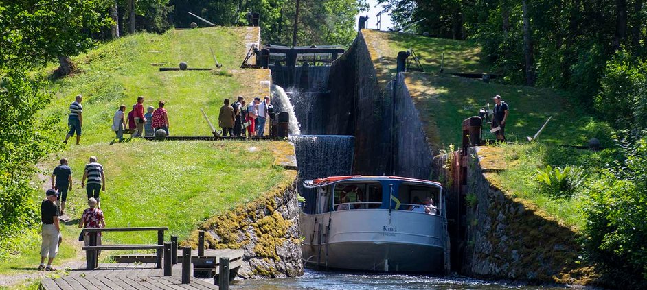
- The locks at Hamra
- The lock stairs in Hovetorp
- Walk along the canal just south of Hovetorp
- Hembygdsgården Fornhemmet
- The deer fence at Fornhemmet
- The area around New Castle in Bjärka Säby
- Säby Västerskog - primeval forest nature reserve
- Nature at Lake Tarmsjön
Map of the route
This stage consists of three shorter stages, so for this hike there are three maps showing the entire hike.
Hiking map as pdf to the first part of the hike, which is between Hamra locks and Bjärka-Säby 7 km.
Hiking map as pdf for the second part of the hike between Bjärka-Säby and Sätravallen 11 km.
Hiking map as pdf to the third part of the hike between Sätravallen and Vårdnäs 9 km.
How long does it take to hike the route?
As the route is approximately 27 km long, you should expect the hike to take at least 8 hours
For who?
The walk is partly on narrower or wider paths, forest roads, dirt roads and on some sections on asphalted roads. The stretch is relatively flat and easy to hike. Just south of Sätravallen is a steeper section with an uphill slope.
How does the hike work?
The hike starts at the locks in Hamra. Look at these locks which are part of the Kinda canal, and follow the dug canal to the next lock area at Hovetorp. The lock stairs there are almost as powerful as the one at Berg's locks on the Göta canal. The trail continues to follow the dug canal for a few kilometers. The trail heads through the oak landscape past the YMCA yard. There is a swimming area. Continue to Hembygdsgården Fornhemmet and look at the beautiful buildings. Next door to Fornhemmet is a deer enclosure that has been on the site since the 17th century. A few hundred meters further on is the castle "Nya slottet Bjärka Säby". A pompous yellow castle. There is a swimming area and a cafe open in summer.
The walk continues past horse paddocks and leads on to a nature reserve called "Säby Västerskog" which is a primeval forest. Here you can walk the reserve loop of 600 meters to experience the primeval forest even more. Just after the primeval forest there is a shelter from the wind.
Part of the hike is on a paved road to Sätravallen by Lake Sätrasjön. There is also a wind shelter with a barbecue area by the water. After that, the walk goes uphill - there used to be a municipal ski slope with a lift on the site. This is how the heart rate increases. The trail passes the Kristineberg summer cottage area and the lake Storsjön where there is a swimming area.
Continue northwest through the forest on forest roads and paths. Pass the lake Tarmsjön - but which the locals call "Trollsjön". The place is reminiscent of a lake in Norrland because of the coniferous forest all around. A stretch here of about 600 meters takes place on a narrow road with some car traffic where the speed is 70 km/h. Soon you will arrive at Vårdnäs after a nice hike.
Water supply:
There is limited opportunity to refill drinking water along the stage, so make sure you have well-filled water bottles from the start.A number of lakes are passed along the way, so there is an opportunity to fill up with water for those of you who have a water filter with you or have the opportunity to boil the water.
How do I find my way along the trail?
The stretch between Hamra lock and Vårdnäs is part of the regional landscape trail Östgötaleden. The trail is marked with orange markings. In most places the trail is easy to follow.This part of the Östgötaleden is marked on a digital map, so the trail is easy to follow on your own smartphone with your own position visible.
Links to more information about the hike:
Digital map at ostgotaleden.se.
How to get to the starting point:
Read more here how to get to the starting point by bus.
Read more here how to get to the starting point by car and where to park.
Other things to consider:
Some parts of the trail go through pastures. During the period from April to September, there may be grazing cows or sheep in the pastures. Do not keep loose dogs in paddocks with grazing animals. Ideally, avoid taking the dog with you into a paddock with cows in it.


