Select language
Sprache auswählen
Route
Bjärka-Säby to Vårdnäs 20 km
Length: 20 km
Highlights of the route:
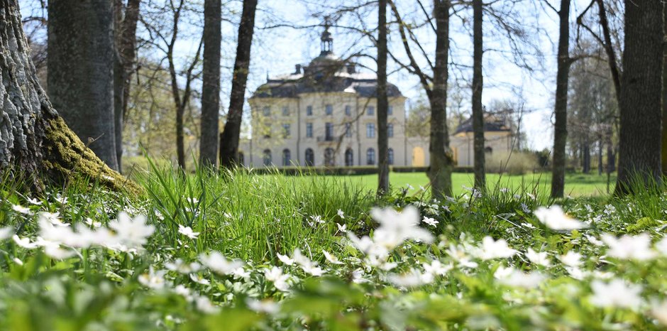
- The surroundings around New Castle Bjärka Säby ("Nya Slottet")
- The primeval forest Säby Västerskog (A primeval forest with magical nature with old trees mixed with fallen trees. Here you can also walk the reserve loop of 600 meters to really experience the reserve).
- Beautiful setting by Tarmsjön (locally called “Trollsjön”)
Map of the route
This stage consists of two shorter stages, so for this hike there are two maps showing the entire hike.
Hiking map as pdf to the second part of the hike between Sätravallen and Vårdnäs 9 km.
How long does it take to hike the route?
The time taken depends entirely on your pace and how many breaks are taken along the way. But count on at least 5-6 hours for the 20 km hike.
For who?
The terrain on the hike is relatively flat with only a few uphill or downhill climbs. The hike is partly on paths, dirt roads and some sections also paved road. You also pass through a primeval forest reserve, but the trail itself is cleared of trees and is relatively easy to pass through.
How do I do the hike?
You start your hike at New Castle Bjärka Säby. You can get there either with your own car or with public transport (bus). The walk goes through a lot of forest scenery, but the walk also passes fields, lakes and small villages. Rest where you see fit. The map you get with you gives suggestions for resting places.
You pass a few lakes on your hike. Depending on the season, maybe it can attract a bath? If it's winter, the bath may have to wait until Vårdnäs, where there is a sauna to warm up in.Finally, you are back at Vårdnäs after a few hours of pleasant hiking.
Water supply:
There is limited opportunity to refill drinking water along the stage, so make sure you have well-filled water bottles from the start.A lake is passed along the way (Stora Mörken), so there is an opportunity to fill up with water for those of you who have a water filter with you or have the opportunity to boil the water.
How do I find my way on the route?
The stretch between Bjärka Säby and Vårdnäs is part of the regional landscape trail Östgötaleden. The trail is marked with orange markings. In most places the trail is easy to follow.This part of the Östgötaleden is marked on a digital map, so the trail is easy to follow on your own smartphone with your own position visible.
Links to more information about the hike:
Digital map at ostgotaleden.se
Get to the starting point:
Read more here how to get to the starting point by bus.
Read more here how to get to the starting point by car and where to park.
Things to think about before the hike:
Please note that there is no possibility to refill water along the way, but you need to carry the water that will be needed with you.
If you will be using your smartphone to follow the map on ostgotaleden.se on your hike, we recommend that you bring a power bank to possibly be able to charge the mobile if necessary.


